产品描述
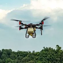
RTK drone solution high precision GPS base station system for measuring satellite positioning mapping
RTK drone using Real-time kinematic (RTK) positioning is a satellite navigation technique used to enhance the precision of position data derived from satellite-based positioning systems (global navigation satellite systems, GNSS) such as GPS, GLONASS, Galileo, and BeiDou. It uses measurements of the phase of the signal’s carrier wave in addition to the information content of the signal and relies on a single reference station or interpolated virtual station to provide real-time corrections, providing up to centimetre-level accuracy. With reference to GPS in particular, the system is commonly referred to as carrier-phase enhancement, or CPGPS. It has applications in land survey, hydrographic survey, and in unmanned aerial vehicle navigation.
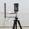
The new CUAV RTK-BASE differential high-precision GPS base station system, built-in multi-star single-frequency RTK receiver module, P900 over-the-horizon data transmission module, WIFI communication module, high-capacity battery pack can work continuously for 12 hours, and run LINUX system, A variety of working modes can be flexibly applied to the fields of drones, unmanned vehicles and so on.
Built-in RTK receiver module:
Built-in high-performance RTK multi-star single-frequency receiver module, with 72-channel channel, support GPS L1 C / A, GLONASS L1OF, BeiDou B1I satellite, RTK refresh rate up to 8HZ, receiving sensitivity -160 dBm.
Run the LINUX system:
CUAV RTK-BASE adopts ARM chip architecture and runs LINUX system. Through reliable and flexible LINUX system, it can expand the application to meet the needs of users in different industries.
- 无人机
- 无人机配件
- 农业无人机
- Spraying Drone
产能:
未通知
运输时间表:
根据订单的规模
Incoterms:
未通知包装明细:
未通知
更多关于
Shenzhen Nuobashi Trading Co.,Ltd
10-50
员工
未通知
100%
% 出口销售额
Year
成立年份
业务类型
- Industry / Manufacturer
- Distributor / Wholesaler
关键词
- 半导体
- 汽车诊断仪
- 无人机
- 示波器
- 电子元器件
联系方式和位置
-
Weili ********
-
+86 1********
-
深圳 / | 中国


